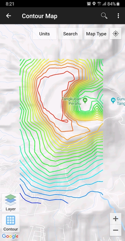
Module to generate contours based on number of contour lines, desired elevation or contour interval. This is premium modul & need internet connection.
UTM Geo Map has ability to generate contours with configurable interval, using sophisticated GRID and TIN interpolation approaches which are also configurable and rich of options. The contour results can be exported to DXF or KML files.

The process of making contour lines in our application is very simple, you only need to zoom the map to the desired location and the process of generating contours will be done automatically. It should be noted that the results are only for the purpose of visualizing the ground surface and not for precission mapping purposes.

Open the module and click Contour button (bottom left) or tap anywhere on the maps to show contour dialog. Make changes according to your needs then click OK, after the contours are created, click on the contour line to see the elevation values or click on contour polygon to see contour area / perimeter.

Contour Elevation Label
To display the elevation label, click on an existing contour and a menu will appear as follows:
Click Show/Hide ELevation Labels then the height label will appear on each contour line as shown below.

In addition to making contours, this module is also equipped with contour editing tools such as edit vertex (move / add vertex), Smoothing (Cubic Bezier Interpolation) and reduce the number of vertex / Simplify (Douglas Peucker Algorithm).
Furthermore, contour lines can be exported to CSV (XYZ), KML and DXF files. For DXF format you can also set the desired Coordinates Reference System by using EPSG code when exporting.
